Option available after logging in Log in or if you do not have an account yet Create an account
Type of file
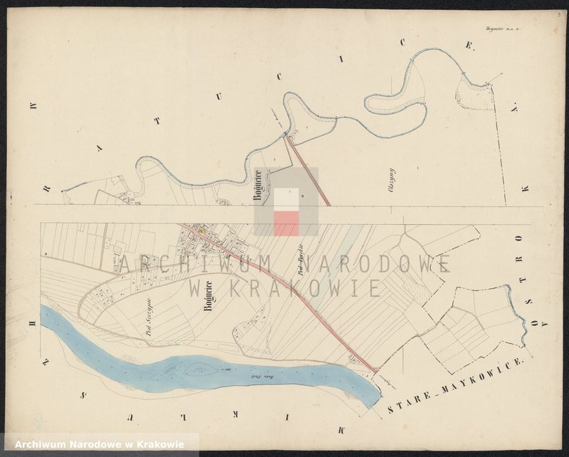
Land survey and cartographic documentation
Translated title
No data
Reference code
29/280/0/4.1/689
Date / Period of creation
1848
Dates
1848 - 1848
Content
No data
Folder reference
No data
Physical condition
Good
Microfilming status
No microfilm
Languages:
niemiecki
Old reference code
K. Chrz. 344, KChrz347
Shared
Yes
Comments
Odbitka litograficzna z 1849 r. Mapa tzw. "wiedenka". Sekcje I-VIII (7 arkuszy), komplet. Na odwrocie podpisy: kolorującego, numerującego, rewidenta, pozostałe nieczytelne. Mapa służyła jako podstawa przy klasyfikacji gruntów w 1936 r.
Option available after logging in Log in or if you do not have an account yet Create an account
Related materials
Bogucice in Galizien Bochnier Kreis Bezirk Niepołomice
1847
195 Dorf Niewiarow [Niewiarów] I-sza część in Galizien Bochnier Kreis
1847
198 Dorf Nieznanowice sammt Enclave Niewiarów II-ga część bestehend aus den Ortschaften Jaroszowka [Jaroszówka] und Podgrodzie in Galizien Bochnier Kreis
1847
217 Dorf Pierszchów [Pierzchów] sammt Enclave Pierszchowiec [Pierzchowiec] in Galizien Bochnier Kreis
![image.from.unit "195 Dorf Niewiarow [Niewiarów] I-sza część in Galizien Bochnier Kreis"](https://photos.szukajwarchiwach.gov.pl/a63f2a69ef138b6d400a625f2e64749bfe88bd9d7e8ffc2ce0d687be5f0738b6_mid)
![image.from.unit "198 Dorf Nieznanowice sammt Enclave Niewiarów II-ga część bestehend aus den Ortschaften Jaroszowka [Jaroszówka] und Podgrodzie in Galizien Bochnier Kreis"](https://photos.szukajwarchiwach.gov.pl/54a1808d8e0924e8d3b2cf4cffc49891aa60f41f94080e989522153f36c1a3ae_mid)
![image.from.unit "217 Dorf Pierszchów [Pierzchów] sammt Enclave Pierszchowiec [Pierzchowiec] in Galizien Bochnier Kreis"](https://photos.szukajwarchiwach.gov.pl/c6ef479f823cb2b4c08f0bf041fcf3541115dfa9357e4be33a897c10f94f569c_mid)