Option available after logging in Log in or if you do not have an account yet Create an account
Related materials
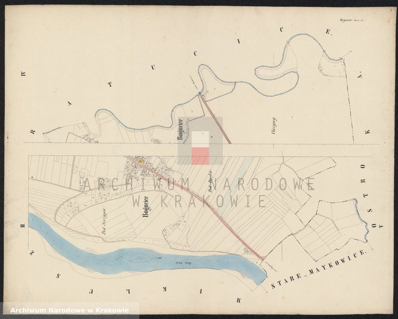
Bogucice in Galizien Bochnier Kreis Bezirk Niepołomice
#Bogucice
1847
195 Dorf Niewiarow [Niewiarów] I-sza część in Galizien Bochnier Kreis
#Niewiarów
1847
198 Dorf Nieznanowice sammt Enclave Niewiarów II-ga część bestehend aus den Ortschaften Jaroszowka [Jaroszówka] und Podgrodzie in Galizien Bochnier Kreis
#Jaroszówka #Niewiarów #Nieznanowice
1847
217 Dorf Pierszchów [Pierzchów] sammt Enclave Pierszchowiec [Pierzchowiec] in Galizien Bochnier Kreis
![image.from.unit "195 Dorf Niewiarow [Niewiarów] I-sza część in Galizien Bochnier Kreis"](https://photos.szukajwarchiwach.gov.pl/a63f2a69ef138b6d400a625f2e64749bfe88bd9d7e8ffc2ce0d687be5f0738b6_mid)
![image.from.unit "198 Dorf Nieznanowice sammt Enclave Niewiarów II-ga część bestehend aus den Ortschaften Jaroszowka [Jaroszówka] und Podgrodzie in Galizien Bochnier Kreis"](https://photos.szukajwarchiwach.gov.pl/54a1808d8e0924e8d3b2cf4cffc49891aa60f41f94080e989522153f36c1a3ae_mid)
![image.from.unit "217 Dorf Pierszchów [Pierzchów] sammt Enclave Pierszchowiec [Pierzchowiec] in Galizien Bochnier Kreis"](https://photos.szukajwarchiwach.gov.pl/c6ef479f823cb2b4c08f0bf041fcf3541115dfa9357e4be33a897c10f94f569c_mid)